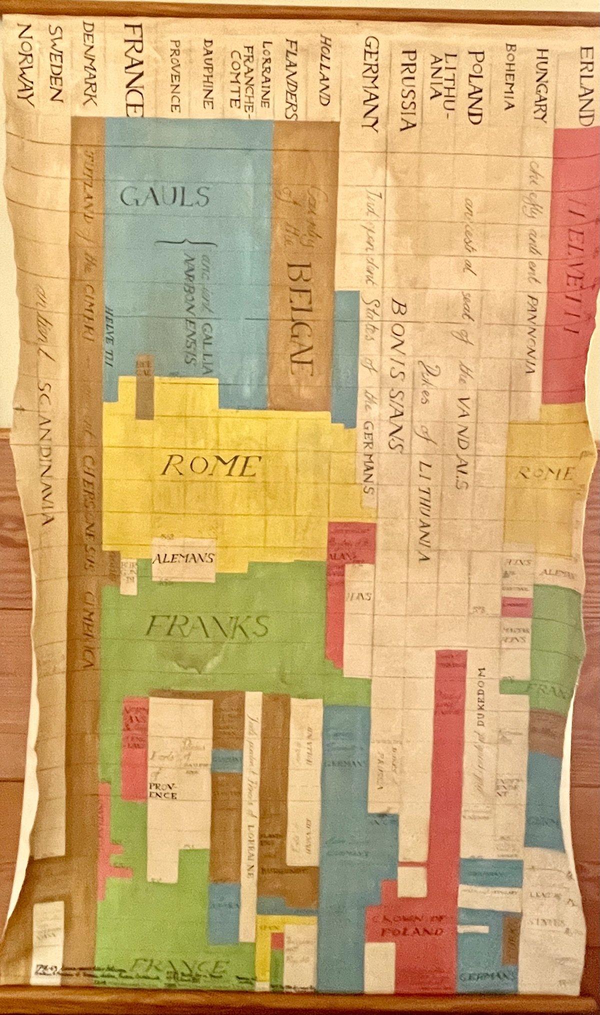
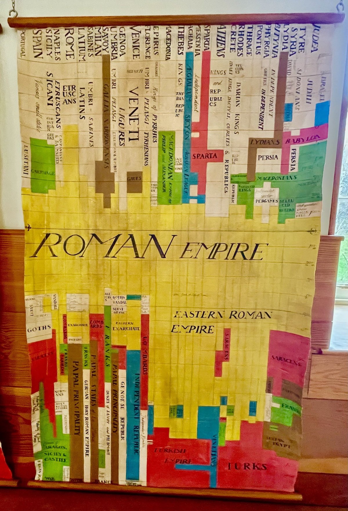
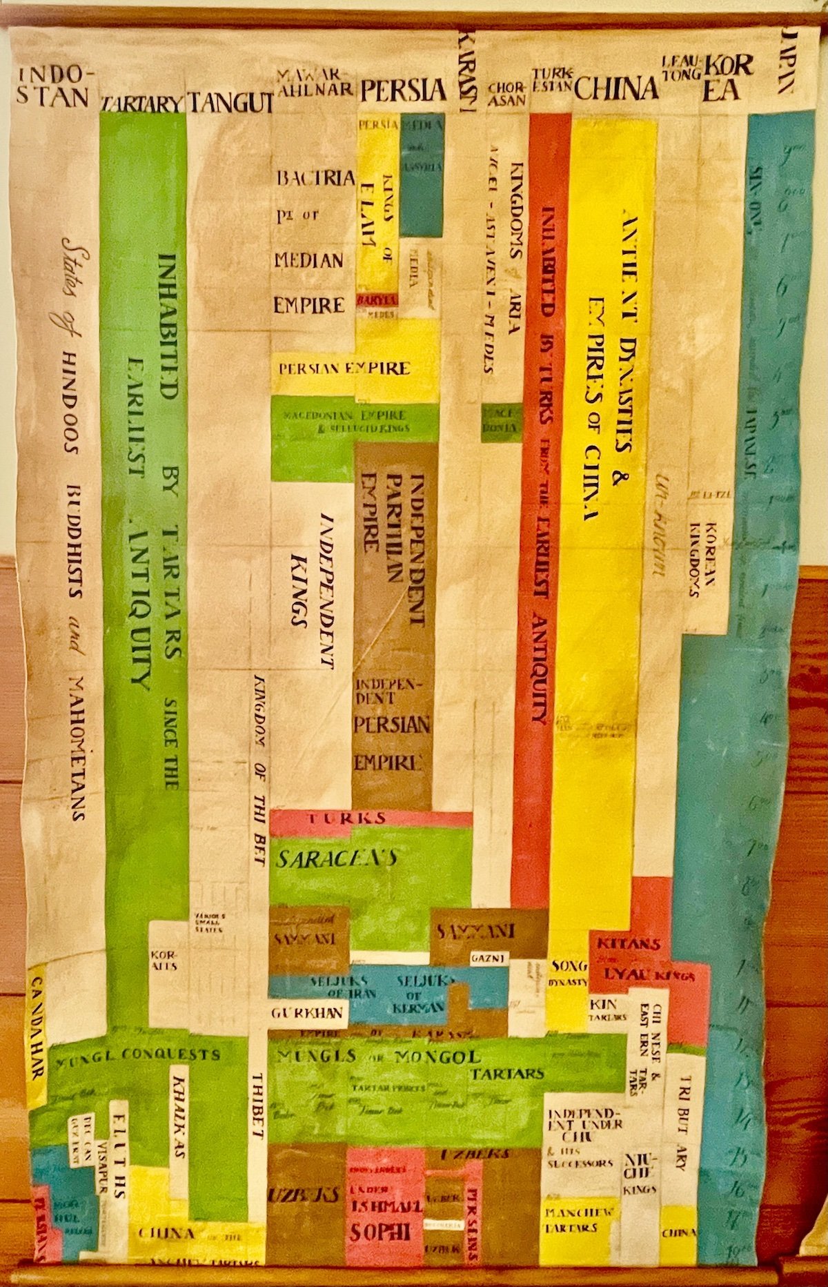
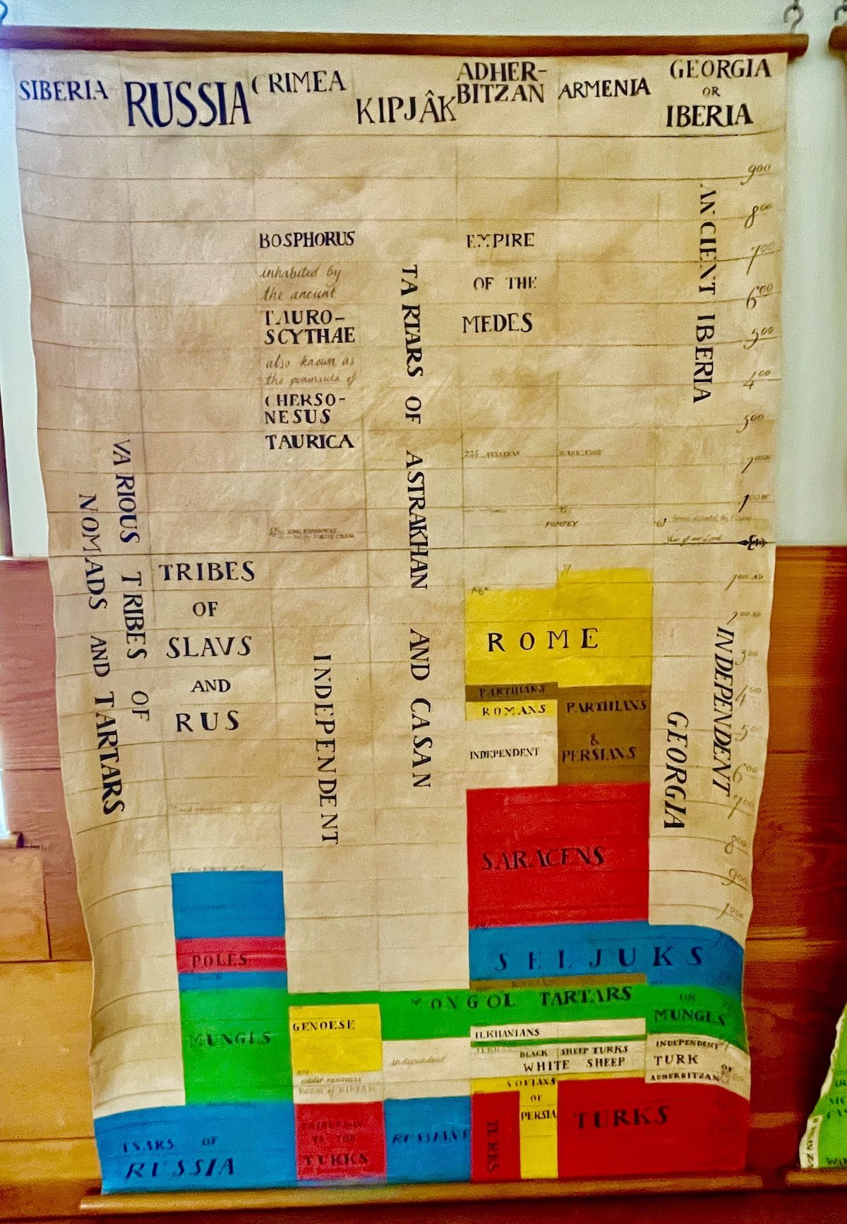
I was in New Lanark in Scotland a few weeks ago, and took many photos. Robert Owen had a school for his workers’ children, and in the beautiful schoolhouse hung these historical maps. I took a bunch of pictures of the maps, and it was only upon returning home to my study that I realized that they bore a striking similarity to the Oxford Cartographers World History Timeline Map that I have hanging on my office wall. This one is organized by territory at the top, to track the various imperial formations of the world at the time. I wonder if this is where the original idea came from?